Cooperative Agreement for CESU-affiliated Partner with Great Plains Cooperative Ecosystem Studies Unit
The U. S. Geological Survey (USGS) Nebraska Water Science Center (NEWSC) is offering a funding opportunityfor test-hole drilling, geophysical well logging, and monitoring well installation along the Niobrara National Scenic River (NIOB).
The NIOB is a 76-mile segment of the Niobrara River that begins near Valentine, Nebraska at Borman Bridge and follows the Niobrara River east to Mariaville, Nebraska at HWY 137 Bridge.
The NIOB is known for its scenic, geologic features of the river valley, its recreational opportunities, and its abundance of fish and wildlife.
These unique characteristics led to its establishment as a National Scenic River in 1991 (Roeder, 2004).
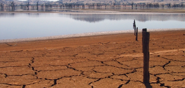
Groundwater discharge from the High Plains aquifer makes up approximately 70% of the Niobrara River’s total streamflow (Shaffer, 1975; Bentall and Shaffer, 1979).
Because of this, the NIOB is highly responsive to changes in groundwater levels.
The High Plains Aquifer is also the primary source of irrigation water in Nebraska and has allowed Nebraska to irrigate more acres than any other state.
Previous studies have indicated that the NIOB and its tributaries are highly influenced by groundwater inflow/outflow (Soenksen and others, 2010, Bentall and Schaffer, 1979); however, groundwater monitoring in the area is sparse and no efforts have been made to relate adjacent stream water levels to groundwater levels.
NPS managers would like to have dedicated monitoring wells and water-level sensors installed at select locations to better understand the groundwater and surface-water interaction along the NIOB.
Future monitoring will be needed to assess how changes to the system (new groundwater irrigation) are impacting groundwater levels and water quality.
If impacts to the groundwater system are discovered, NPS managers will be better equipped to determine what management actions are needed to protect the NIOB.
USGS is pursuing research on the subsurface characterization and assessment of groundwater and surface-water interaction along the NIOB.
The NIOB is a 76-mile segment of the Niobrara River that begins near Valentine, Nebraska at Borman Bridge and follows the Niobrara River east to Mariaville, Nebraska at HWY 137 Bridge.
The NIOB is known for its scenic, geologic features of the river valley, its recreational opportunities, and its abundance of fish and wildlife.
These unique characteristics led to its establishment as a National Scenic River in 1991 (Roeder, 2004).
Groundwater discharge from the High Plains aquifer makes up approximately 70% of the Niobrara River’s total streamflow (Shaffer, 1975; Bentall and Shaffer, 1979).
Because of this, the NIOB is highly responsive to changes in groundwater levels.
The High Plains Aquifer is also the primary source of irrigation water in Nebraska and has allowed Nebraska to irrigate more acres than any other state.
Previous studies have indicated that the NIOB and its tributaries are highly influenced by groundwater inflow/outflow (Soenksen and others, 2010, Bentall and Schaffer, 1979); however, groundwater monitoring in the area is sparse and no efforts have been made to relate adjacent stream water levels to groundwater levels.
NPS managers would like to have dedicated monitoring wells and water-level sensors installed at select locations to better understand the groundwater and surface-water interaction along the NIOB.
Future monitoring will be needed to assess how changes to the system (new groundwater irrigation) are impacting groundwater levels and water quality.
If impacts to the groundwater system are discovered, NPS managers will be better equipped to determine what management actions are needed to protect the NIOB.
USGS is pursuing research on the subsurface characterization and assessment of groundwater and surface-water interaction along the NIOB.
Relevant Nonprofit Program Categories
Obtain Full Opportunity Text:
https://grants.nih.gov/grants/guide/rfa-files/RFA-AI-24-011.html
Additional Information of Eligibility:
This financial assistance opportunity is being issued under a Cooperative Ecosystem Studies Unit (CESU) Program.
CESU’s are partnerships that provide research, technical assistance, and education.
Eligible recipients must be a participating partner of the Great Plains Cooperative Ecosystem Studies Unit (GP CESU) Program.
Full Opportunity Web Address:
http://grants.nih.gov/grants/guide/rfa-files/RFA-AI-24-011.html
Contact:
Agency Email Description:
fgraves@usgs.gov
Agency Email:
Date Posted:
2024-03-21
Application Due Date:
Archive Date:
2024-09-04
Social Entrepreneurship
Spotlight
Rwanda as Social Entrepreneur Fund Beneficiary

The Republic of Rwanda has been picked as one of the six African countries as beneficiaries for a new fellowship fund program designed at supporting social entrepreneurs in tackling issues on food security.
Learn How to Identify and Avoid Grant Scams